Longmont Main Street Corridor Plan
Consultation has concluded
In 2018, the Longmont City Council established their vision for Longmont's places, which is "In 20 years, Longmont will have a developed Main Street from Pike Road to Highway 66 and a river corridor that stretches from the sugar mill to the fairgrounds providing a vibrant economic, residential, cultural and entertainment epicenter that is sustainable and respects the natural environment."
This place based vision is closely tied with and supported by Envision Longmont and numerous other plans that recognize the Main Street Corridor as the “heart” of the community. The City recognizes that there is an opportunity to look at and think about the future of the Main Street corridor, and to identify and discuss potential changes along the corridor that will leverage our local economy and the quality of our community for decades to come.
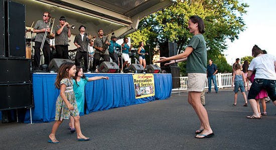
Beginning last year, the City of Longmont set out to develop a plan, high-level goals, and vision for fortifying and improving the Main Street Corridor to reinforce it as the City's cultural, commercial and business center. The 5-mile long corridor extends from Highway 66 on the north to Plateau Road on the south. The Main Street Corridor plan will address the need to carry multiple transportation modes safely and efficiently on Main Street, while revitalizing the area, and creating opportunities for mixed-land use projects over time.
The 12-month Main Street Corridor Planning effort is coming to a close! The presentation from last public meeting on September 10th, draft executive summary, and draft Main Street Corridor plan are now available online:
- Download the presentation
- Download the draft of the Main Street Corridor Executive Summary
- Download the full Main Street Corridor Draft Plan
Thank you to everyone who participated in the planning process. The project team is wrapping up final edits for the plan and will bring it to City Council for approval on October 22nd. Check back for the final version of the plan.
Recommendations - North Main
- Increase mixed use, residential, entertainment along Main Street; redevelop underutilized parking
- Add pocket parks, plazas, landscaping, and trees
- Create additional East-West and North-South street connections
- Improve safety of Main Street Connections
- Leverage future Bus Rapid Transit Stations
- Provide entry signage into Longmont at State Highway 66
We would like to hear specific recommendations from the community. Using the corresponding pins, please mark where you would like to see the following:
- Green spaces or plazas
- Improved landscaping and/or additional trees
- Crosswalks and/or new street connections
- Restaurants
- Entertainment
- Housing
Recommendations - Midtown
- Create a Paseo/Mercado Promenade from 11th - Mountain View Ave
- Add Mixed-Use infill on underutilized parcels
- Add pocket parks, plazas, landscaping, and trees
- Create additional East-West and North-South street connections
- Improve alley accesses to businesses
We would like to hear specific recommendations from the community. Using the corresponding pins, please mark where you would like to see the following:
- Green space/ plazas
- Improved landscaping and/or additional trees
- Additional alley access to business
- New street connections
- Infill development opportunities (Mixed-Use, Restaurants, Space for new and/or expanding businesses, Retail, Housing)
Recommendations - Old Town
- Strategic infill of downtown parking lots for residential, office use, and mixed-use
- Create additional pocket parks and plazas for nodes of interest
- Address difficult turning movements (i.e. left turn from Main onto 9th Avenue)
- Provide safer crosswalks and intersections
- Link Main to the 1st and Main transit station
- Enhance connections to Dickens Farm Nature Area and the River
We would like to hear specific recommendations from the community. Using the corresponding pins, please mark where you would like to see the following:
- Green space / plazas
- Crosswalks or other intersection improvements
- New bicycle and/or pedestrian connections
- Infill development opportunities (Mixed-Use, Restaurants, Business or Office Space, Retail, Residential)
Recommendations - South Main
- Strategic infill opportunity from St. Vrain Creek to S. Emery Street
- Connect existing and planned development to Main Street
- Provide consistent sidewalk widths and work to reduce speeds where feasible
- Provide additional trees and landscaping
- Create new bicycle/pedestrian connections, particularly north/south
- Add new entry signage to Main Street and downtown near Plateau Road
- Improved landscaping and/or additional trees
- Additional routes and or/ connections for bicycles
- Crosswalks or other intersection improvements
- Infill development opportunities (Mixed-Use, Restaurants, Entertainment, Business or Office Space, Retail, Residential)
Signup Banner

Who's listening
-

Phone 303-651-8336 Email mainstreetplan@longmontcolorado.gov -

Phone 303-651-8634 Email Sandra.Seader@longmontcolorado.gov
Level of Engagement

- Inform: Give information to the community
- Consult: Obtain feedback from the community
Document Library
-
 Main Street Corridor Plan [DRAFT] (31.8 MB) (pdf)
-
September 10, 2019 Public Meeting Presentation (8.66 MB) (pdf)
-
Draft Main Street Corridor Executive Summary (10 MB) (pdf)
-
Second Public Survey Results_June 2019 (890 KB) (pdf)
-
Character Area Recommendations (886 KB) (pdf)
-
Catalyst Site Recommendations (4.04 MB) (pdf)